How Kakao Map leveraged InstaLOD to scale up their 3D processing capabilities across multiple projects.
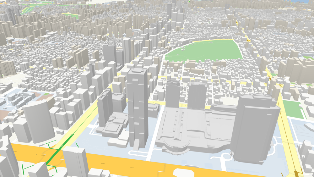
Kakao is a platform for mobile and connected life in Korea providing a wide range of innovative services in messaging, maps and more. Since 2019, InstaLOD has been a key technology in its map and navigation application Kakao Map, and in particular the 3D Skyview service that visualizes Korea's cities with stunningly lifelike 3D renderings. Soon the technology company realized, however, that InstaLOD's capabilities and excellent performance could also be employed elsewhere in their organization: The VectorMap service and HDMap project.
Enabling enterprise companies to implement a sustainable 3D strategy throughout their organization while achieving massive time and cost-savings.
¶ VectorMap x InstaLOD
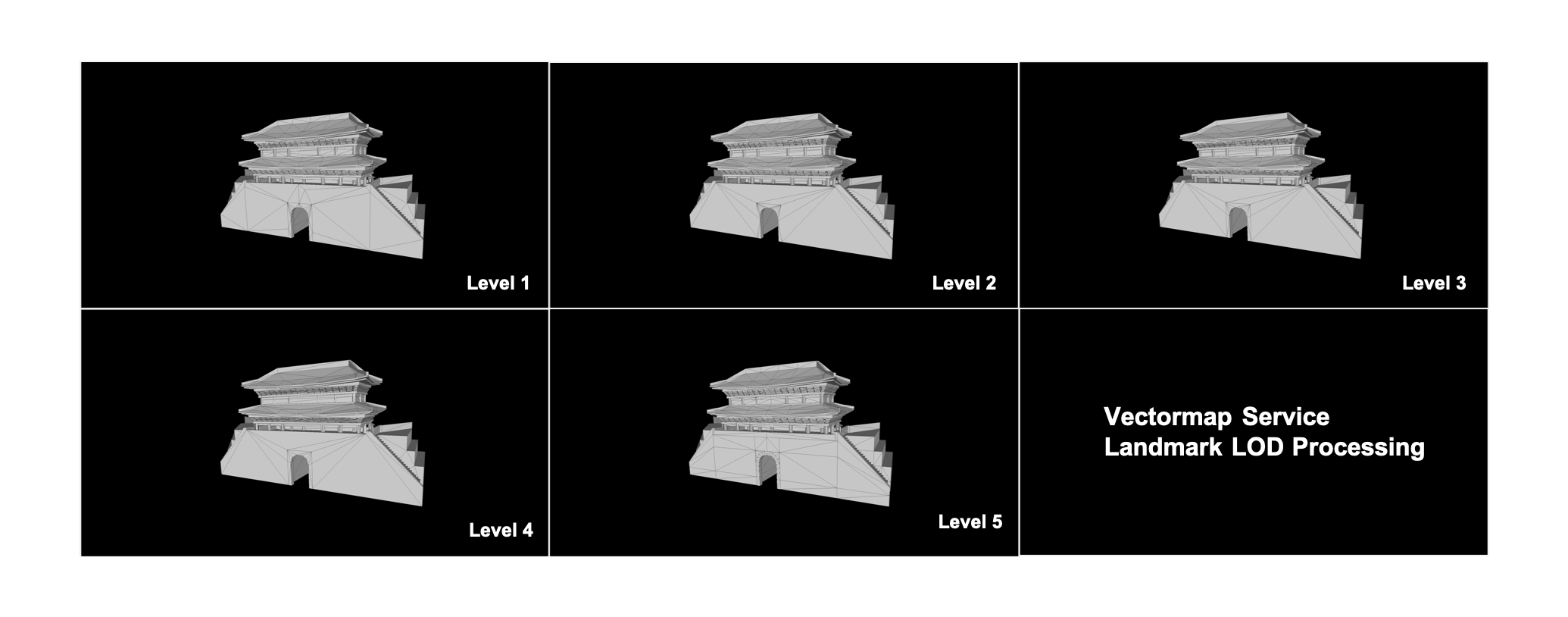
VectorMap is one of Kakao Map's core features. It's a three-dimensional city map that allows its users to easily navigate through the bustling streets of Korea's metropolises. As opposed to conventional image-based maps, buildings are constructed from vectors, leading to a much lighter and faster application. However, this type of map required orientation points for its users to be easily understandable. The team decided to enrich the map with a variety of landmarks found in Korea's cities, knowing that only recognizable and concise models would work for this purpose. Ultimately they settled on modeling all landmarks by hand. Each of these models also had to be optimized and made available in multiple Levels of Detail (LOD) to keep the solution light - an incredible investment of time and effort to achieve manually.

But here's where InstaLOD came in: Generating LODs with InstaLOD for Autodesk 3ds Max tremendously reduced the workload. The resulting LODs retained both shape and details perfectly and with skyrocketing efficiency, the production time per asset was more than halved.
¶ HDMap x InstaLOD
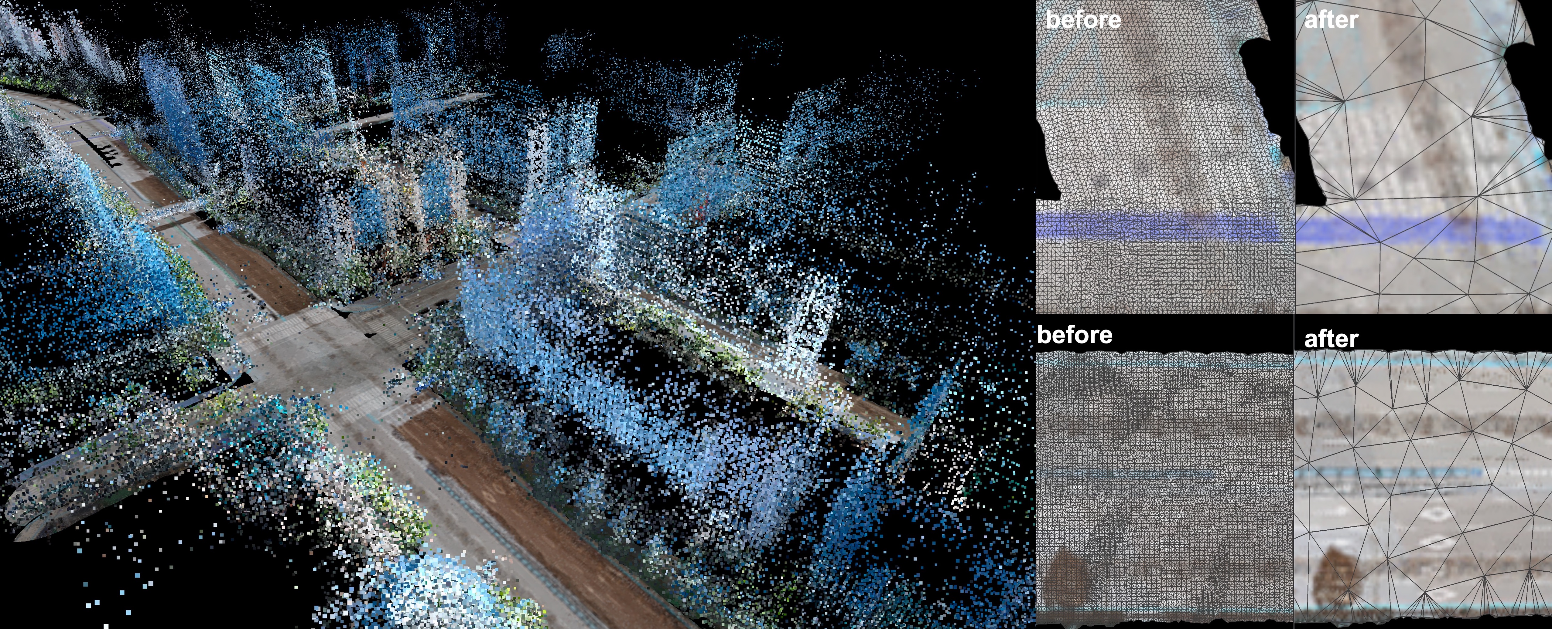
HDMap was the third venture at the company that greatly benefited from InstaLOD. The goal of the project was to automatically generate a complete 3D virtual space based on images. The team first constructed a 3D point cloud through the positional correlation of 360-degree images. This point cloud then underwent a series of refinement steps and was ultimately transformed into a polygon mesh. Simplifying the resulting mesh was the final step in the process - and here's where the problems began.
Shapes were collapsed and entire areas were unintentionally removed. When the team made the switch to InstaLOD the difference was palpable. InstaLOD reliably detected borders and maintained shapes, removing only those polygons that were not needed. Almost 95% of the original polygon count could be removed and InstaLOD processed assets about 50x faster than their previous method.

In the end, InstaLOD was able to save a tremendous amount of time and effort for both projects, delivering effective LODs and a quick processing method for a variety of usage scenarios.
Watch the video case study on Kakao's 3D Skyview service at www.InstaLOD.com/Kakaomap
First published: 1st Aug 2023